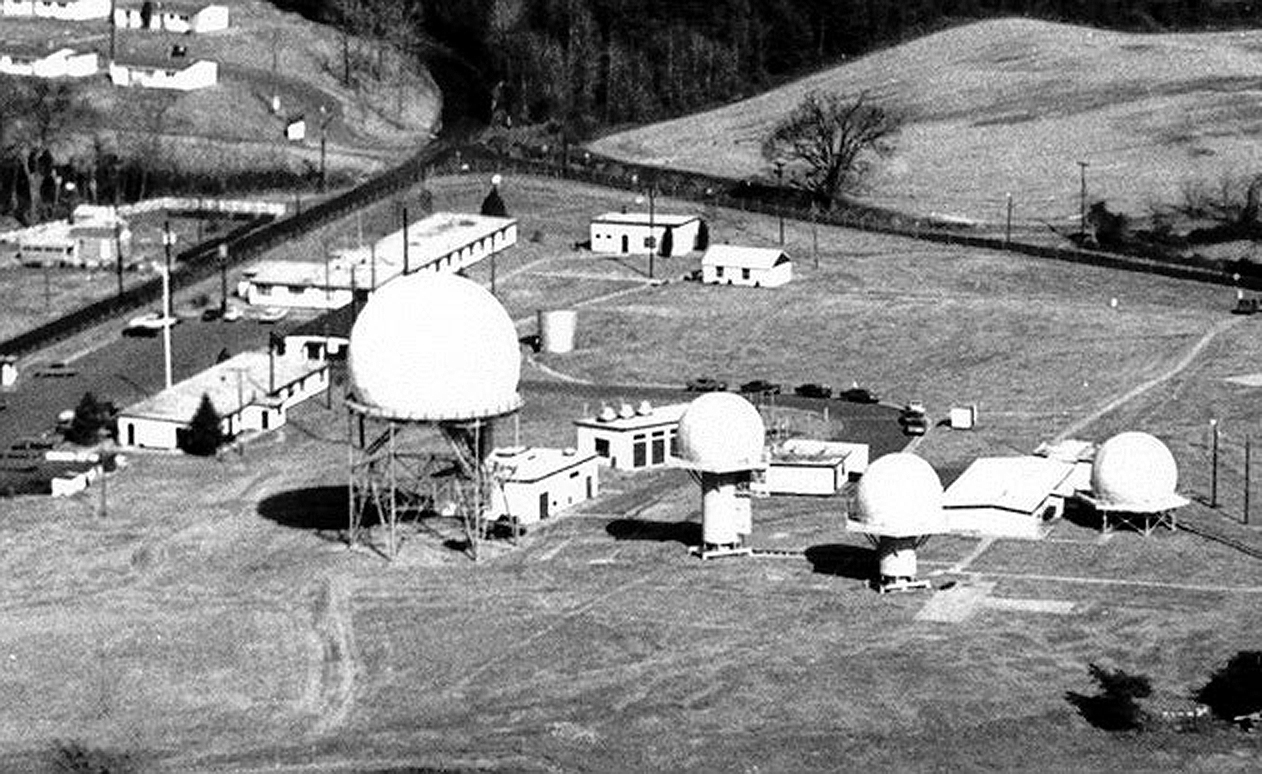
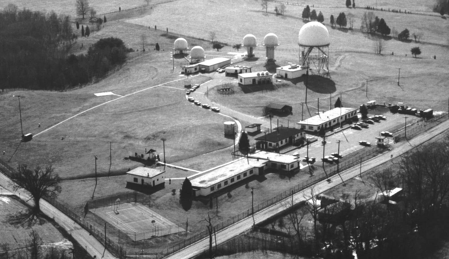
1972 (IFC) Integrated Fire Control Area (Click to enlarge)
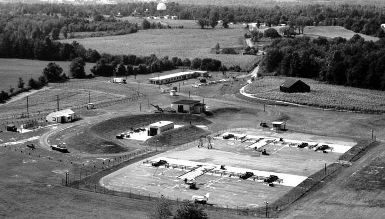
W-25 was built on nearly 60 acres of land in Davidsonville, Maryland. Intersecting roads were the Queen Anne Bridge Road and Wayson Road with the Elmer F. Hagner Lane, which leads to the launcher area. The offical location is listed as "2 miles west of Davidsonville on State Rt 214 and Queen Anne Road. Access Road: State Rt 214; Queen Anne Road." The ground control guidance equipment was located on approximately 6 acres. The Control Area which includes, the HIPAR Radar, Acquisition radar, Target Tracking Radar, Missile Tracking Radar and the Target Ranging Radar along with two vans, The Fire Control Van and the Missile Tracking Radar Van.
The Capital Newspaper May 11, 1968 - Interview of commanding officer, Capt. Francis V. Saunders, at B-4-1 page 10 and continued on page 23
A Launcher Area is located about 1 mile away from the Control Area on 42 acres. The operating facility consist of 15 acres with the remainding acreage as a safety/security area.